It can be fun to make a quick decision, and one of the best things about camping in camper vans is that you do not need too much preparation and luggage, so you can start your trip with short notice.
That is how I got a little idea one Friday morning on the 21st of August at work when I saw the weather forecast was going to be fine for the next few days in late August. I sent my husband Sverrir, the Happy Boss, a message from work as he was in a meeting in Reykjavik if he was up to go for a 4-5 days road trip with me as I had in mind a few places I wanted to see this year. The answer was, of course, a yes, and I saw one Happy 4×4 available for 5 days, so let’s go!
Day 1
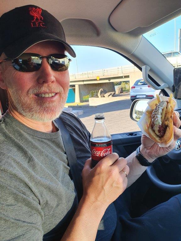
We met at home in the afternoon, packet the much necessary things and head to the supermarket to buy some groceries, and headed to road no 1 south. We have been married for 34 years now, and still, we find it so much fun to travel together, and it kind of like gives us always the same old – feeling free – as we were young? We drove to Selfoss and had our first stop as it was dinner time, and as we knew, we would be late in the night at our destination for the night. In Selfoss, there is a little hot dog shop, and as we did not want to spend time now in a restaurant, we went there and also, as Sverrir said, “they simply have the best hot dog in Iceland!“
As I said in the beginning, I had few places I wanted to see this year, and I had not seen before, and the first one was Þakgil. Þakgil is located between Myrdalsjokull and Myrdalssandur and is known for its beauty. To go there, we had to continue to drive road no 1. It is always fascinated to drive past the Eyjafjoll. Many foreigners from Europe know this name, Eyjafjallajokull (located in Eyjafjoll), as it made newspaper headlines across the globe in the spring of 2010. Eyjafjallajokull, which is the 6th biggest glacier in Iceland, erupted in the year 2010 from Mars to June and caused a lot of damages in the nearest fields with farmers. Eyjafjallajokull has been world-famous ever since as it caused that flight traffic stopped in many places in Europe for six days, and we Icelanders were blamed for it in some TV interview -as we had a secret key to the volcano to tease the people in Europe?
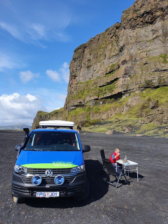
We had to pass Vík for a few min drive East to drive to Þakgil, but it is located approx. 14 km from road no 1. The road into Þakgil is adventurous, and we were so lucky with the view and weather. This road is surrounded by beautiful mountains, and the powerful glacial river Mulakvisl met my expectations. Sverrir had been there a few times on his motorcycle, but as you know, nature and landscape are never the same, and it can be so different between days. We arrived at the camping place around 9 pm and parked the camper under a big rock, and I imagined that we would sleep well as the elves in the rock would be sleeping too! Believing in elves has a deep root in the soul of Icelanders, but in the old days, our ancestors strongly believed that these little people and other creatures lived in nature with humans. And as I knew, we slept like an angel in the night and woke up to a beautiful morning and decided to have a small hike before heading further East.
Day 2
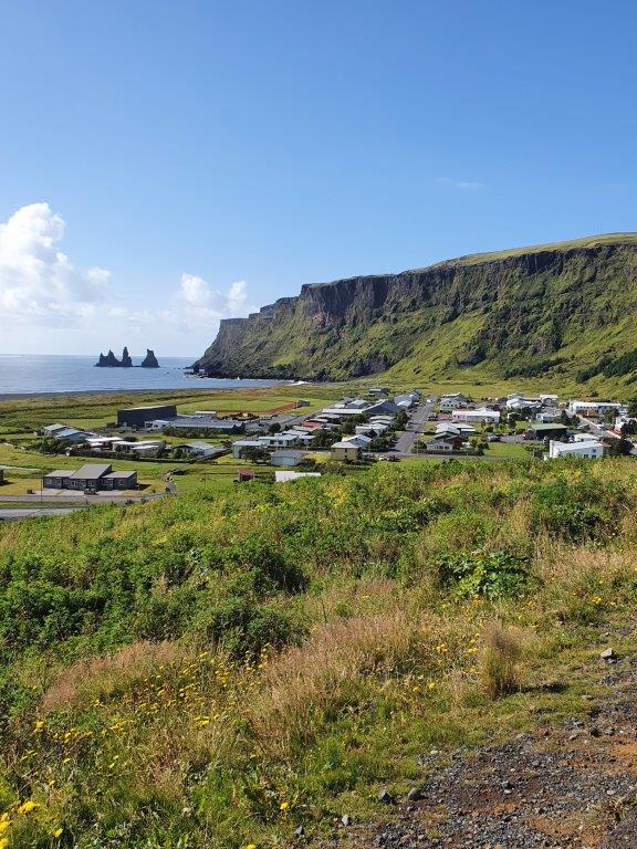
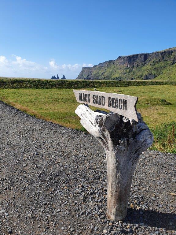
Around 11 am, we started the trip again and decided to go back to Vik as it is only 5 km driving back. I wanted to go to my favorite restaurant in VIK, The Soup Company, which is a small family-owned company, but then Sverrir had some surprise for me, so instead of having soup there, he said he was inviting me for lunch at a special place in nature. We drove a little bit around town and enjoyed the view of the black beach from the parking lot at the church.
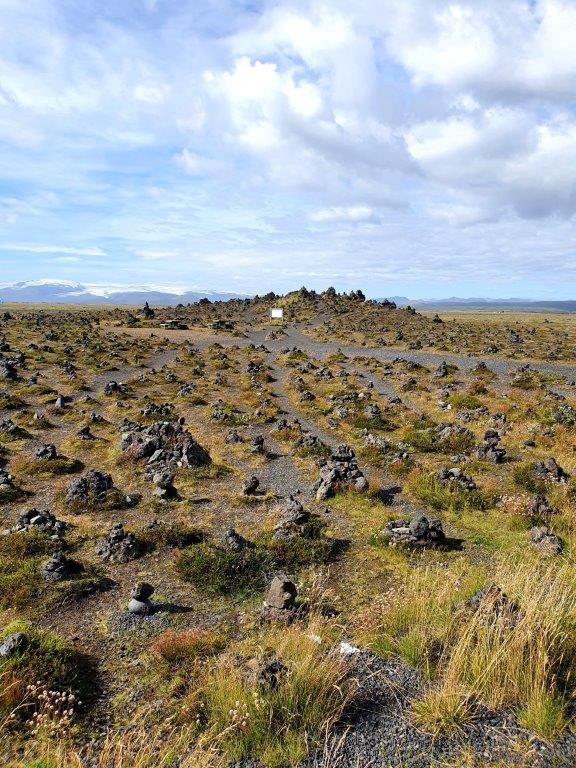
Next destination was Hjorleifshofdi, aprx. 15 km East from VIK, very difficult to pronounce it, like Eyjafjallajokull. The name was given to the mountain, which is 221 m / 725 ft, by one of the first legendary settlers and is believed to have been an island some thousand years ago. The black sand south of the cove is called Kötlutangi on became the most southern point of Iceland after the Katla glacier run in 1918. This is where Sverrir wanted to take me to lunch, and we had a wonderful lunchtime there, sitting outside alone in the world enjoying Icelandic meat soup. Charming experience. After enjoying the environment and visiting a big cave there, we started our trip again, heading further East, driving through Myrdalssandur. But we had not driven long when I wanted to stop for few minutes to walk around Laufskalavarda. A lava ridge surrounded by stone cairns, all travelers in the old days crossing the desert of Myrdalssandur for the first time, we’re supposed to pile stones to make a cairn which would bring the good fortune of the journey.
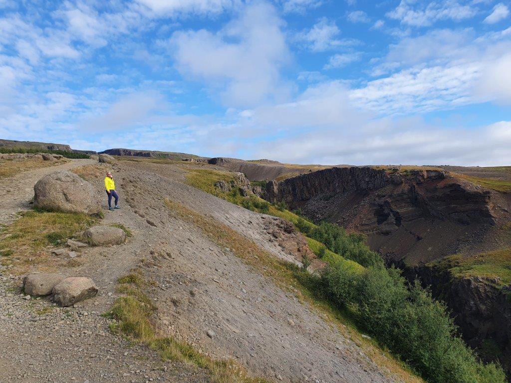
From there we drove approx. 30 minutes and I was excited because next destination was Fjardargljufur that I had not seen yet even though I had passed this canyon so many times before.
On our way there, we drove through an impressive lava field, Eldhraun, and it is kind of like watching the carpet of the earth driving through this landscape. This enormous lava field, 565 sqkm/ 218 sq mi occurred during the Laki ( volcanic fissure in the western part of Vatnajökull )eruption in the late 1700s. This eruption from Laki lasted from 1783 to 1784 and is known worldwide as Skaftareldar and is considered the most poisonous eruption during historical times. About 20% of the human population was killed, and the loss of domestic animals was also in high number.
Fjardarglufur is near Kirkjubaejarklaustur and few min. Drive from road no.1 Most simple way is to drive to the canyon on-road Laki/Holtsroad, and there are good parking lots and Wc for visitors. The canyon is about 100 meters long and a little over 2 km long, and we were approx 30-40 min to hike the path along the canyon while we often stopped to enjoy the view of this magnificent canyon. There is also a nice viewing platform, and I had to admit that I had butterflies in my stomach while looking down from one of those platforms. It is believed that some 9-10.000 years ago, a forceful glacial river ran from the glacier edge through the Fjardarglufur, creating this enormous, beautiful canyon leaving only the harder rock behind. Fjardarglufur is on the register of natural monuments in Iceland and is worth visiting, and we spent over one hour there enjoying this beautiful magnificent landscape in many colors.
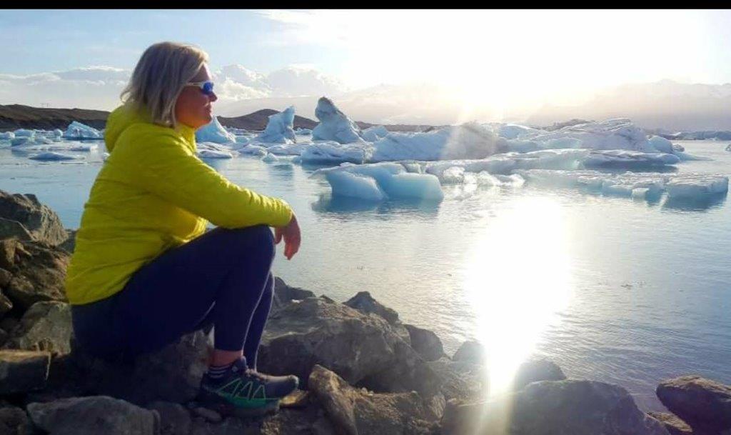
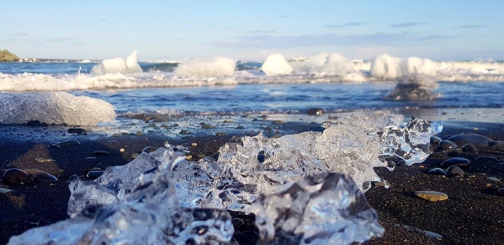
But now it was time for coffee and cake as that is always important! We drove to Kirkjubaejarklaustur and went into this little coffeehouse Systrakaffi (Café of sisters), where we got a nice cup of coffee and pecan pie. After this break, we headed off to Skeidararsandur, which I like so much for its raw beauty. It is a large area of black sands, reaching from Skeidararjokull, which is a part of the biggest glacier in Iceland, Vatnajokull, and to the sea. It covers an area of 1300km2 and was formed as the glacial rivers in the area washed material to the see. Driving through this area and seeing Vatnajokull getting closer and closer is beautiful and especially when you are lucky with clear blue sky. This time we saw Hvannadalshnjukur, which is a pyramidal peak ( 2110m) located in Oraefajokull volcano in Vatnajokull, and that is not every day you can see it. Sverrir has twice hiked this peak with his mountain skis on the back, so it was about time that I saw it, at least? Not far away is the Glacier Lagoon, and we decided like so many times before to stop there as it is a must stop. You never get bored to see the seals swimming around the huge icebergs which are floating around. The Diamond beach nearby was beautiful in the late day sunshine leaving chunks of ice on a black sand beach. There I had myself a nice happy hour sitting at the beach with the force of nature.
But now it was time to get to the destination of the night, and we decided to drive to Hofn, which is a small fishing town in the south/east part of Iceland. They are famous for their lobster, and there are some good restaurants in Hofn. It took us about an hour’s drive from the glacier lagoon to enter the campsite at Hofn. The weather was getting a little bit colder and windy, but we had a really nice camping there, barbequing some lamb in the night. Early night sleep, and it was cozy to hear the wind all around; we slept well. Not all foreigners like the wind, but as an Icelander, I need to hear the wind every now and then and especially on winter nights!
Day 3
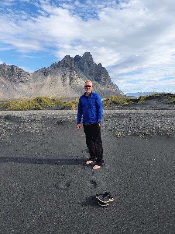
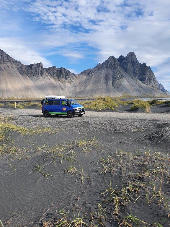
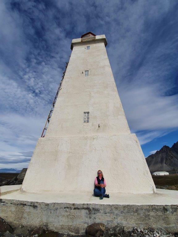
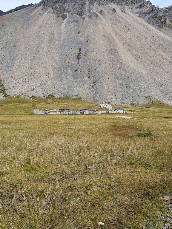
We woke up on a bright day, and the sun was shining, and we had a small breakfast, but I was excited because this morning we were going to see the mountain Vestrahorn in Stokksnes, which I had not seen before. It took us about 20 minutes to drive to Stokksnes from Hofn. Stokksnes is a privately owned land, and we went into a very friendly coffee house there, The Viking Café, to buy access to the area. The fee was very fair, or 900 ISK per person. We met the owner there, a farmer that had lived there all his life on a farm called Horn, and he told us a little bit of history from the area. F.ex In the Second World War, the Horn area became a base for the British army and later a Nato radar station south of Horn. It is necessary to drive or walk to the end of the peninsula to see the mountain in its all glory. A 454-meter-high mountain and those who are interested in geology or photography, this is a must-stop. We drove to the end of the peninsula and stopped on our way to walk in the black sand – sand dunes, and it felt warm taking your shoes off, and that was quite nice. There is a lighthouse at the end of the peninsula where we went to feel the power of the Atlantic Ocean as the waves hit the rocky shore with massive force. The view from there to see Vestrahorn is magnificent and this a mountain you will never forget. On our way back, we decided to have a short walk to see the Viking Village, which was created (scenario ), to make a movie film that has not yet been taking place. The first settlers are believed to have gone to Iceland in the second half of 9 the century, but historians do not all agree with that, and some think it was earlier. There are some written sources in Icelandic from the 12th and 13th century which provide some details about the settlement in Iceland. But it was a lovely walk, and we were alone in the village and let our imagination out and thinking about the old times when people lived in maybe villages like this and turf houses later.
But now it was about time to keep on driving east and to the east fjords, and it was about lunchtime, so we needed to find someplace to stop and eat. In Alftafjordur (Fjord of swans ), we saw a picnic table aside from the road, and there we parked the camper. And what a view! Beautiful swans everywhere in the sea “talking” or singing and nature all around. We Icelanders eat a lot of Skyr, and that is so convenient to have that in the fridge on the road if you want a quick lunch, skyr with some cream, flatbread with smoked lamb was our lunch that day, and it was perfect in this landscape.
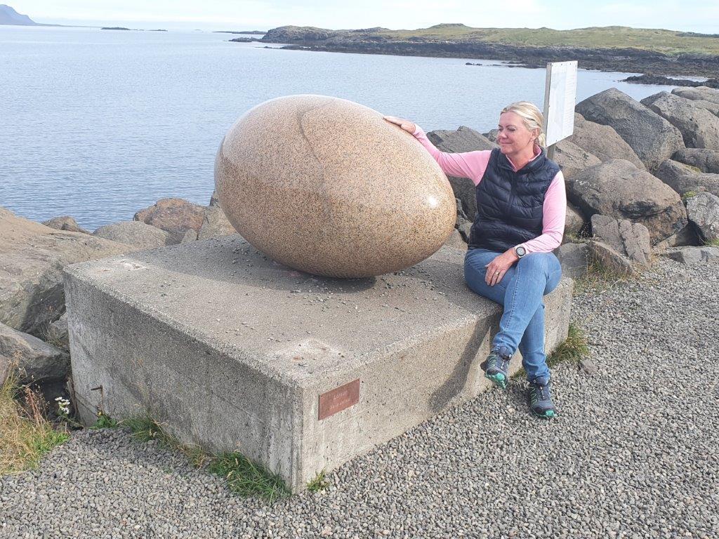
From Alftafjordur, we drove to Djupavogur, a small fishing town with a population of about 500. Sverrir and I always stop there in Langabud if we have the chance. The Langabud ( Red house ) is an old house on Icelandic measurement, and the oldest part is from the 18th century. It has been rebuilt and fixed but in the same style as in the old days. There is a small museum there also about Icelandic sculptors and a little coffee house—also a small heritage museum for those interested in history. Having coffee, we decided that we would end our day in Egilsstadir (the biggest town in the East), and we bought a ticket online to the new geothermal baths in Egilsstadir, VOK at 7.00 pm. It was about time to keep on driving East, but before that, we had to stop at the artwork, The eggs in Gledivik. Really amazing sculpture work created by an Icelandic artist. The outside work consists of 34 huge granite eggs, representing the egg of each of the nesting birds in this area. Many of them are migrating birds, flying over to Iceland from far away to lay their eggs on this Island in the north.
The midday and afternoon we spent driving the East fjords with its peaked mountain and passed some small fishing towns on our way. I must recommend everybody to visit Petra’s Stone Collection in Stodvarfjordur but we did not stop at this time as I had done it twice before, first in my graduation trip from my Tourist Guide School many years ago and then some years later with my daughter. But this stop does not only show you the spectacular rocks/stones of the east, but it also demonstrate what one person can do, and in this case a woman that was fascinated by all the different rocks that she could find in the east and carried to her home.
If you have time, make a stop on those little fishing town in the east as every one of them has its own peculiarities. ( sérkenni ) In some of them you can see the impact of other nations influences, i.e. Farskrudsfjordur with it’s road names both in Icelandic and France. There is a war time museum in Reydarfjordur which if very interesting to visit and more and more interesting places to see and experience in this little towns in the East. But we were on our way to Egilsstadir to have a relaxing bath after a long and good day. This Baths were opened in the year 2019 and the spring water is directed to a series floating pools on the lake as well as hot pools on the lakeshore. We were an hour in Vok and it was wonderful experience and everything there was really tasteful.
Egilsstadir is kind of service town in the East and they have a nice camping place in town, but we decided that we wanted to go to Atlavik and camp there for the night. But as it was almost 20.30 pm. we decided to be lazy and went out for dinner. We went to a place called Salt Café and bistro and ordered hamburgers and Sverrir went for a burger in lava bread which he said was very good. Good service and good food and what do you want more in life.
Atlavik is located in the Hallormsstadur woodland, and we had to drive apx 20 minutes to go there. But I really wanted to see this place in late August, and I was not disappointed. Surrounded by trees and the situation on the shore of Lagarfljot, it was a beautiful place to visit. We slept well there and were tired after a long day.
Day 4
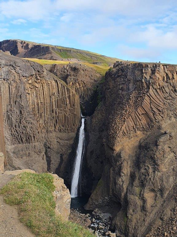
The next morning we woke up around 08.00 am and had some breakfast and discussed the following day, and enjoyed a coffee outside at the camping place. We decided to hike to Hengifoss this morning before going to lunch at Skriduklaustur. It took us only a few minutes to drive to Hengifoss from Atlavik, and some other travelers had also arrived at the parking place with the same idea this morning. Hengifoss is one of the highest Waterfall in Iceland, about 128 meters, and you need to hike for about 2 km to see the Waterfall on good trails. We took our time, no rush, as the view on the way up is quite beautiful. On about halfway up, man can see the Litlanesfoss (Waterfall) with the beautiful basalt columns. Hengifoss is picturesque, and there are visible layers between numerous Tertiary lava strata that yield a reddish color in the cliffs around the waterfall. It took us an hour and a half to hike up and down to the parking lot and enjoyed the view and the whole trip.
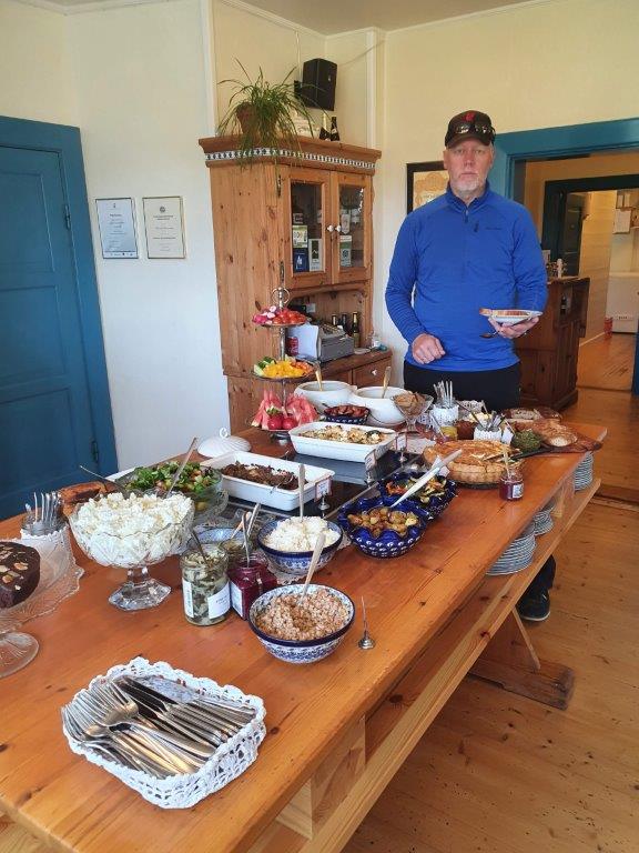
Skriduklaustur has been my favorite place to visit since I went there for the first time. And that is related to food! They have such a wonderful homemade buffet at lunchtime and also a great homemade coffee table in the afternoon. This house is also one of the most special houses in Iceland. An Icelandic writer, Gunnar Gunnarsson, had this house built as his family home, and it was designed by a German architect. Gunnar and his wife lived there only 9 years and later ( 1948); when they moved to Reykjavik, they gave the mansion and all of the farm to the Icelandic nation to be forever owned by the Icelandic people. Skriduklaustur is also a historic site as the name Klaustur means cloister. There are ruins of the 16th-century monastery there, which many might think interesting to see.
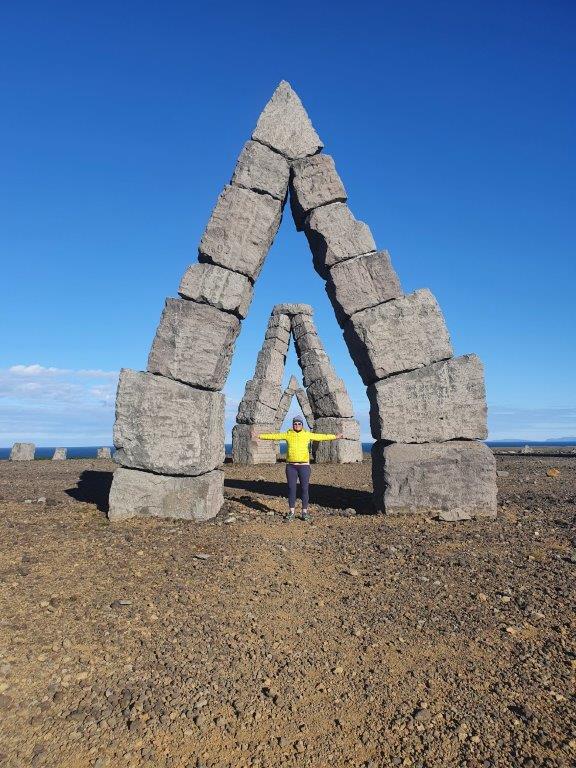
After delicious lunch, we were ready to keep ongoing. We wanted to visit some of the little towns in the North-East part of Iceland, and Sverrir had one special road on his wish list – and thankfully, he had not described it for me in advance! From Skriduklaustur, we drove then to Vopnafjordur. You can choose from 2 roads to drive to Vopnafjordur, either take road no 1 and then 85, and that is a lovely drive, but Sverrir wanted to take road no 917. And little did I know! I am not so much for a high mountain road, and this one was too high for me, and I had my heart in the trousers all the way up and down! But I must admit it was beautiful to drive this and see all the views from the top. After this adventurous drive to my standard, we passed Vopnafjordur and drove to other smaller towns, Bakkafjordur, Thorshöfn, and Raudarhofn, which is the most remote northern villages in Iceland. Little out site of Raufarhofn is the Arctic Henge which we both had not seen before. A human-made artwork, a monument to Asatru, the belief of the old Norse. Some kind of sun clock is not yet finished, but If you have any chance to go there some time, I strongly recommend that you stop there and see this biggest outdoor artwork in Iceland and read about it. It is quite impressive.
From there, we drove Melrakkasletta. An area in the most North-East part of Iceland, flat and lowland plain. There is a lot of driftwood on the coast of Melrakkasletta, making the coastline very unique. This is a very remote part of Iceland, and we got the feeling we were alone in the world, and that was a nice feeling. I would think that this plain is a paradise for those who love nature and birdlife.
The last night we spent in Akureyri, the biggest town in the north. We skipped visiting the Myvatn area as we had been there often and had not still camped before in Akureyri. We drove in the night to the campsite, Hamrar, a little bit outside of the town, located in the Kjarnaskogur ( woodland). There we spent the night and were able to see the most beautiful sunset in the north late at night.
Day 5: last day
Day 5 and our last day! When we packed for the road trip, I had said to Sverrir it would be nice to take our golf clubs with us, and he thought we would not have time to do any golfing. – But I knew better, and it had been my wish for some years to go and play the 9-hole course in Siglufjordur. I have plaid some courses in Iceland, and the one in Akureyri is one of my favorite 18 holes, but I had heard so many talks about Siglufjordur. So, we drove there with a short stop in Dalvik – again for coffee, but I like this coffee house there very much, Gisli, Eirikur, and Helgi. From Dalvik through the tunnel to Olafsfjordur and then again, other tunnels and Siglufjordur, Iceland’s northernmost town, and a historic fishing town, and there is a very informative Herring Era museum there.
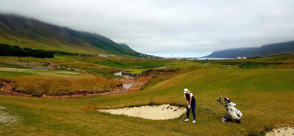
The golf course is located near their skiing area, so it lies among the mountains and is a beautiful country golf course in the North, and we had a wonderful game and enjoyed it very much. After the game, we went downtown to have some late lunch and enjoyed watching the life on the harbor.
It was afternoon, and we knew it would take us about 4-5 hours to drive home, so it was about time to leave and head home as we did not have more days to spend on this small road trip. Happy and tired, we arrived home in the night, and it felt like we had been on the road for 10 days as we did so much.
I hope that you who read this blog of mine have enjoyed it, and if you like, you may always send me an email ( herdis@happycampers.is) if you want to have some help preparing your trip to Iceland in the nearest future.
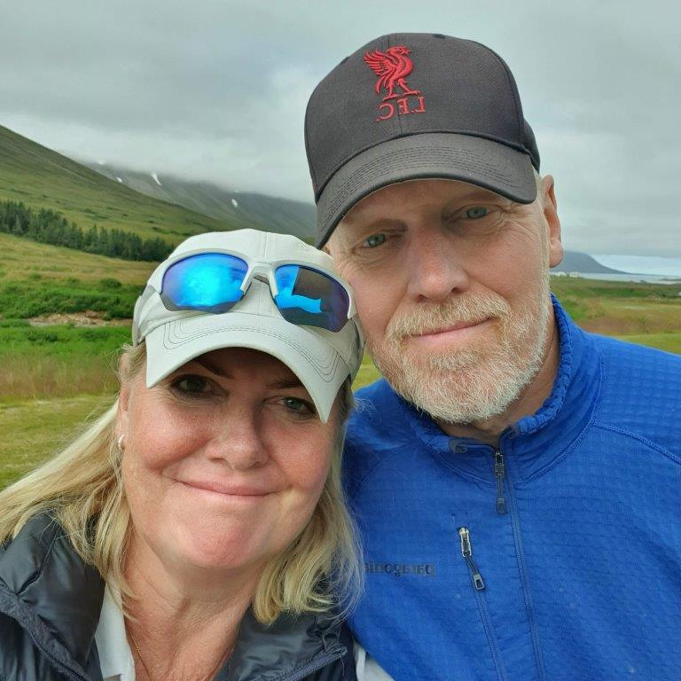
Thanks a lot for reading xxx Herdis & Sverrir
Back