4×4 Insurance
When venturing into the highlands, your risk of car damage increases significantly. Rough roads, stream and river crossing, and more severe weather can sometimes result in some car damage, no matter how careful you are. For this reason, it’s important to understand your insurance options – what is actually insured and what isn’t. Make sure to ask your rental agency to explain their terms and options carefully when you arrive at the office or before you book.
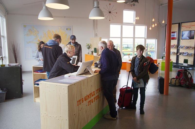 Going over insurance terms and options
Third-Party Liability Insurance vs. CDW
Car and campervan rentals in Iceland are required by law to offer basic third-party liability insurance. They should give you information about the details of this included insurance. We at Happy Campers offer this insurance through our insurance partner, VÍS, and provide a link to the detailed policy terms on our Terms & Condition page. If you are driving a vehicle without this insurance, your camper van rental is breaking the law.
Collision Damage Waiver (CDW) is a voluntary policy where the company “waives” its rights to charge you for the full damage. Instead, it sets a limit on how much you will have to pay in case of damage (self-risk). At Happy Campers, the self-risk is EUR 2,500. So even without purchasing any insurance, you can at least find some comfort in knowing that the CDW is included. If you total a EUR 25,000 4×4 camper, for example, you only pay 10% of the total damage. Even though most rentals include a CDW, remember that it’s voluntary, so make sure to check if your rental offers it and what it looks like.
I put Reykjanes on this list for many of the same reasons I chose Snæfellsnes; it’s close to Reykjavik, has a lot of attractions in a small area, and makes for a perfect easy road trip surrounded by beautiful Icelandic nature. To read about my experience exploring Reykjanes peninsula in November, check out my other blog post:
Policy Term Restrictions
Each company can set their own terms and conditions regarding what is covered and what is not. Make sure to read the policy terms carefully. Most rentals use the same terms provided to them by their insurance company. Some policy term restrictions are very common or industry standard, so it’s important to keep them in mind. You are NOT covered and your CDW is not valid in the following cases:
- If you are driving in water – even if it’s only a small stream
- When you are driving off-road
- Damage to wheel, tire, or windscreen
- Damage to the chassis caused by scraping the ground or protruding rocks.
These are just some of the most common 4×4-relevant policy restrictions that you need to be aware of. This list doesn’t include the more obvious restrictions, such as when you drive under the influence of alcohol. Even if you buy the most comprehensive extra insurance package, you might not be covered for this type of damage. However, usually you can find extra insurance options that deal with some of these policy limitations. Common extra insurance options include Gravel Protection and Tire Insurance. If you’re driving a 4×4 campervan, you should seriously consider the following extra insurance options for your trip:
- Super CDW: Lowers the self-risk significantly
- Gravel Protection: Protects you from damage to the front of the vehicle caused by flying rocks (very common on F-roads), including the windshield, hood, and headlights
- Tire Insurance: The second most common type of damage, after gravel damage, in the highlands. Remember that it’s not just the cost of the new tire but also the expensive labor of changing the tire.
Safety Tips
Nobody lives in the highlands for a good reason. The weather can be extreme, there is limited phone reception, and almost no gas stations. Therefore, it’s absolutely critical that you don’t travel alone in the highlands unless you are very experienced. Getting stuck in a river without any help and no cell phone reception would be a nightmare. Always make sure that you are prepared, have enough water, food and diesel to last you the full trip.
Check out the safety chapter in our Winter Camping in Iceland guide, where we write in-depth about general safety tips and safety resources.
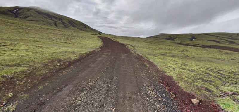
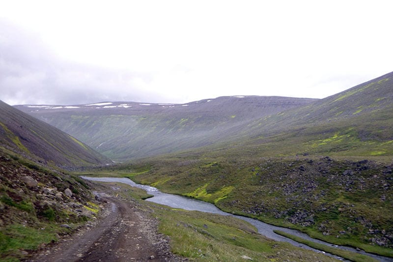
Driving on Gravel Roads
Driving on rough gravel roads or mountain paths requires the driver’s full attention and some skill. It’s important to go slow in most scenarios and scan the road for unexpected obstacles or changes in the terrain. Unlike paved roads, there will be no road signs, so you will be forced to use your judgment about what is wise and what is not. You might be forced to drive on loosely packed sand, snow, or ice, which means the wheels might not get any good traction.
It will also affect your braking distance and your 4×4 campervan’s turning capabilities. Drive in a low gear, go slow, but don’t stop. Stopping completely or hitting the gas too hard is the most common reason people get stuck in difficult situations.
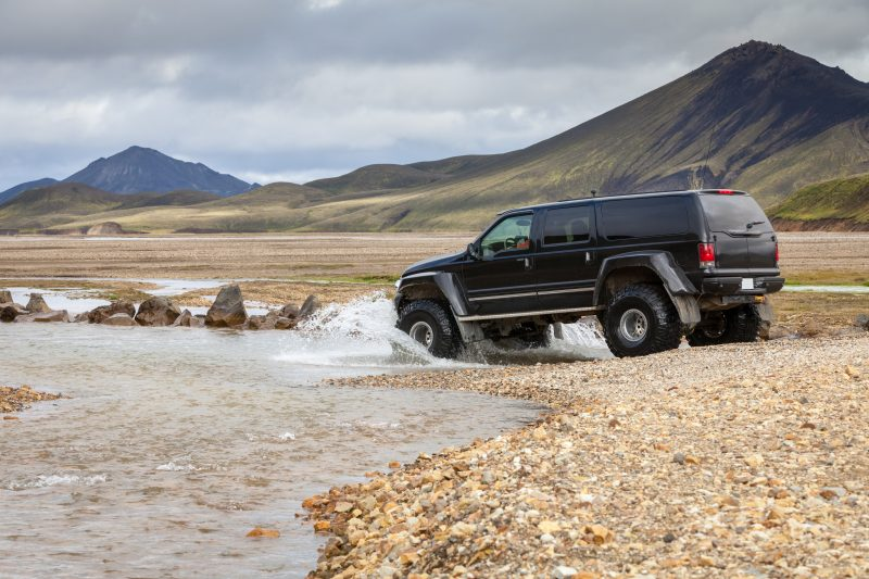
River Crossing
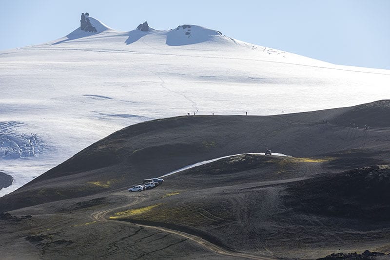
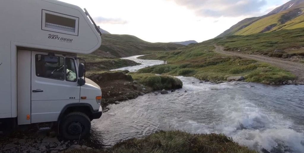
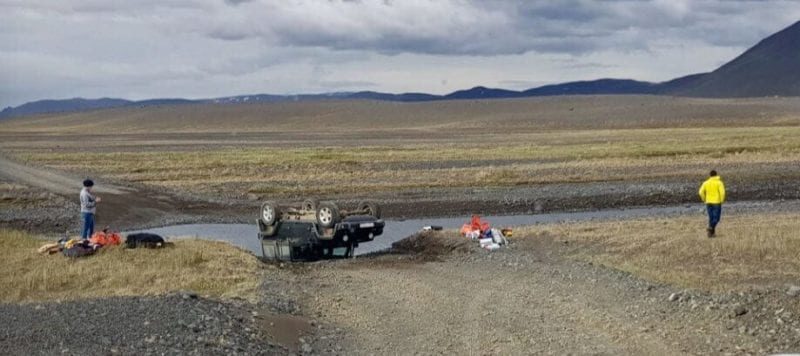
One of the many challenges you can face in the Icelandic highlands is unabridged rivers that require drivers to cross at river fords. This can be quite dangerous, even in a 4×4 camper. And remember, as mentioned above, you are not insured in these situations. If you flood the car engine, for example, you would have to pay the entire bill, which is not limited to the self-risk amount. This can be extremely expensive and is more common than it has to be.
Many rentals forbid any type of river-crossings. Happy Campers actually allows it, but heavily advise against it if you can avoid it. We have a sophisticated tracking system in all of our vans for travelers’ safety, which will alarm us whenever a driver enters a forbidden area. This could result in fines equal to the traveler’s self-risk and is common industry practice. See the section below on F-roads for a list of forbidden roads.
The most commonly asked-about river crossing area is on the way to Landmannalaugar. Fortunately, it’s a rather shallow ford, so it shouldn’t be too dangerous. But keep in mind that this can change very fast. In general, it’s impossible to predict the conditions, depth, and velocity of rivers, as it depends on the unpredictable weather. This is why using your common sense and erring on the side of caution is crucial.
 Road to Landmannalaugar
Safety Resources
It’s always a good idea to check www.vedur.is for the weather forecast from the official source of the Icelandic Met Office before you plan to venture into the highlands. If heavy rain is expected, for example, or a bad storm, it would be wise to wait for a better day. Rivers might be deep, and roads might become muddy, so always make sure you know the weather forecast. You also want to know the condition of the roads you’re about to explore and www.road.is, published by the Icelandic Road and Coastal Administration, is the go-to website for that information.
If you plan on going for walks or hikes, please leave your travel plan on www.safetravel.is so our search and rescue teams know if you get lost. This is especially important if you are traveling alone, but we recommend it for everybody.
Highlands Accessibility
For most of the year, the Icelandic highlands are covered in snow, and the roads are closed to the public. Generally, the F-roads open in the first half of June and stay open until the end of September. However, this can vary as the weather in Iceland varies drastically year to year. Sometimes many of the roads don’t open until late July, and sometimes they don’t close until late October – it’s impossible to predict. Ultimately it depends on snow cover, and even when the snow is melted, the roads can remain closed while they are very wet and muddy.
Road.is displays the best information about F-road conditions and accessibility, so make sure to look through their site before venturing into the highlands. You can also call +354-522-1100 for the latest information by phone.
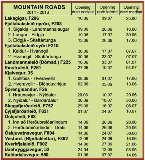 Road openings vary year-to-year, depending on the weather
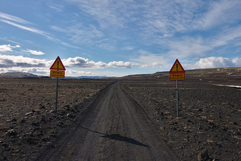 Do not drive pass these signs!
Off-Road Driving
Off-road driving in Iceland is strictly forbidden to protect the untouched nature we value so much. It can be tempting to drive off the small paths that sometimes don’t look too different from the surrounding environment. It’s important to realize that the tire tracks your 4×4 camper leaves might take years or decades to disappear. Always be respectful and stay on the roads.
Legally speaking, you can expect heavy fines and jail time up to 2 years if you break these laws. Technically, you are allowed to drive on snow in conditions such that the tires never touch the ground and therefore don’t damage it. However, we advise against this and suggest that you should always let nature get the benefit of the doubt. Please read this brochure on off-road driving from the Environment Agency of Iceland.
Not only can you expect fines and possible jail time in Iceland if you are caught driving off-road, but you can also expect public ridicule. Icelanders and the Icelandic press are infamous for being highly critical of those who do not respect nature. Off-road driving cases are frequently top news stories, such as here, where some French travelers were arrested and fined EUR 3,500 for off-road driving. So please don’t be like Justin Bieber when in Iceland. Use common sense, and don’t drive off-road.
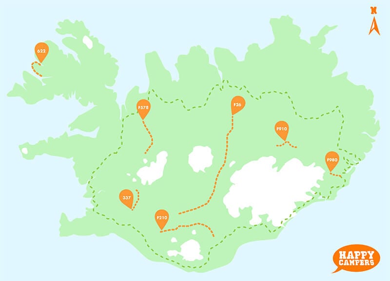
F-Roads
“F-roads” is what we call mountain roads here in Iceland. Mountain roads are only open during the summertime and require a 4×4 vehicle. The “F” comes from the word “Fjallavegur”, which literally means “mountain road”. Most of the F-roads are located in the Icelandic highlands, although some or not. Technically, all lands above 300 meters sea level is considered a part of the highlands. More generally, however, the we consider the center of the island to be the highlands.
When the snow melts in the spring and summer, the F-roads start opening and becoming usable again. However, these first few days and weeks of reopening are often the most dangerous, so keep that in mind
It’s important to know that some F-roads are not marked with the letter F, even though they are mountain roads. These roads are Kaldidalur valley (road 550) and Kjalvegur (road 35). Please be aware of these roads in particular as you can only drive them in a 4×4 camper or car.
If you are looking for detailed information about any F-Road in Iceland, we highly recommend check out our friend’s from Epic Iceland list.
Dangerous Roads
There are also several roads that can be particularly difficult and are often off-limits, even when driving a 4×4 in the summertime. At Happy Campers, we allow all F-roads unlike most other rentals. You will find that many car and campervan rentals go so far as to ban 30-50% of all mountain roads, even when driving a 4×4. Take a look at their website or read the small print in their terms & conditions before you book the van that you expect to be able to explore the highlands in.
Our approach is to educate our travelers so that they can make good decisions for themselves, knowing all the risks. A part of that education is to talk about some of the most dangerous mountain roads in Iceland. These roads are known to cause travelers significant issues and we strongly advise against using these roads in most cases. We’re going to mention 7 roads in particular:
 Dangerous roads: These roads are dangerous and not recommended
622 (Westfjords)
This is a dangerous passage from Fossdalur to Thingeyri in the Westfjords. Even though this road does not have a river crossing and is not marked as an F-road, unlike all other roads on this list, it is simply too difficult to drive. This mountain passage is not suitable for most 4×4 cars, including the Happy 4×4 van, so we strongly suggest avoiding it.
F578 (Arnarvatnsvegur)
This dangerous road is located north of Langjökull and features some extremely dangerous river-crossings. Use this road at your own risk. More detailed information about this road in the perfectly titled article: “Road F578: a slippery as hell mudhole”.
F337 (Hloduvallavegur)
This unmarked mountain road is located north of Laugarvatn. It is extremely difficult to drive and one of the steepest drives in Iceland. Drive this road at your own risk!
F210 (Fjallbaksleid Sydri)
Fjallbaksleið Syðri lies between the popular highland areas of Landmannalaugar and Þórsmörk. It includes very difficult terrain and dangerous river crossings, so it is forbidden for all seasons.
F210 – We don’t recommend taking your chances on this road. Video: Marcin Kleszcz
F26 (Sprengisandsleid)
This is the only road that is both on our do not recommend list and our favorite list.. There are aspects of this route that can be very dangerous, most significantly the two river crossings towards the middle of the route. This is why F26 is on our do not recommend list. The two rivers are glacier rivers and can be extremely dangerous. But this is also a long road (232 kilometers) and there are aspects of it that you can easily explore. Driving the entirety of it is what we strongly advise against. Keep in mind that there are also no gas stations along this route. See more of what we love about it below in our favorites section.
F26 – The most dangerous parts of this road are at the center of it. Video: Lukasz
F910 (Austurleid)
This route leads to Lake Askja, north of Vatnajökull glacier. It is a very difficult road with dangerous river crossings, so we highly advise against using it.
F980 (Kollmuluvegur)
This road can be very dangerous and is only suitable for 4x4s with very high ground clearance and experienced drivers. Even though it’s only 25k km long, it is extremely challenging and we do not recommend using it.
All F-Road
So now that you know which roads to avoid, let’s look at all the other F-roads that you can happily explore. This numerical list is fairly exhaustive and includes almost all mountain roads in Iceland so feel free to reference this list when planning your route.
550 (Kaldidalsvegur)
In our “Favorites” section below.
622 (Westfjords)
In our “Dangerous” section above.
F206 (Lakavegur)
This mountain road is located near Lakagígar and can be quite challenging. It starts from the ring road and is 41 km long. Expect the drive to take a while, as it is riddled with potholes and rough terrain.
F206 – video: Ocharni
F208 (Fjallabaksleid Nyrdri)
This route cuts right through the highlands from the south and is 102 km long. The road crosses several rivers, so be cautious after heavy rain or later in the evenings. The road offers amazing views of the rugged highland landscape, volcanoes, and lava fields.
F210 (Fjallbaksleid sydri)
In our “dangerous roads” section above.
F225 (Landmannaleid)
In our “favorites” section below
F228 (Veidivatnaleid)
This route in the south offers breathtaking scenery but requires plenty of concentration and caution. It runs from F26 towards Skálavatn lake, or about 21 km. Driving this road will make you feel like you’re on the moon.
F228 – Driving on the moon. Video: Mini-Cap
F233 (Alftavatnskrokur)
This 21 km route is beautiful, although difficult in true Icelandic mountain road fashion. With large potholes and boulders, you can expect to move slowly. It contains a river crossing, which we strongly advise against doing. However, the majority of the route is beautiful and well worth the drive.
 F233 – A beautiful drive until you reach the river, when it gets dangerous. Photo: dangerousroads.org
F249 (Thorsmerkurvegur)
The majority of this road is fairly easy to drive and beautiful. It leads to the highly popular Þórsmörk area, so many people make this trip every summer. However, at the very end of the route, you will be required to cross the dangerous Krossá river. We have personally witnessed many drivers get stuck there and a traveler even died there a few years ago. So unless you are extremely confident and experienced, we don’t recommend crossing this river.
F249 – Crossing Krossá is not recommended. Video: Cedric Weber.
F261 (Emstruleid)
Located in the south by the black ash desert of Mælifellssandur, this 40 km route features some amazing landscapes but can be dangerous as it features some river crossings. It runs from the Þórsmörk area towards Fjallbaksleið Syðri and the Hvanngil Huts. It also runs along the famous Laugavegur trail, which we highly recommend for experienced hikers! We recommend only traveling this route in daylight and good conditions, paying attention to water levels.
 F261 – A beautiful route along the famous Laugavegur hiking trail. Photo: dangerousroads.org
F337 (Hloduvallavegur)
In our “dangerous roads” section above.
F338 (Skjaldbreidarvegur)
This 51 km route runs east from Kaldidalur towards Kjalvegur (F35) near the famous Gullfoss waterfall. This road was originally made as a powerline service road and gets minimal maintenance. It includes river crossings, so it deserves the appropriate caution and experience. Although the river crossings are usually modest, do not drive this road in the dark or when water levels are high.
F347 (Kerlingarfjallavegur)
Man, that’s a long name for a road. But that’s Icelandic for you. This road has been driven many times by owners Herdis and Sverrir who spent a lot of time in the Kerlingafjöll mountain area, in the center of the country. However, it can be a challenging drive and might not be suitable for those who are afraid of heights. It includes a couple of river-crossings, where one is definitely more challenging than the other. Stopping by the Gýgjarfoss waterfall is definitely worth it on this route.
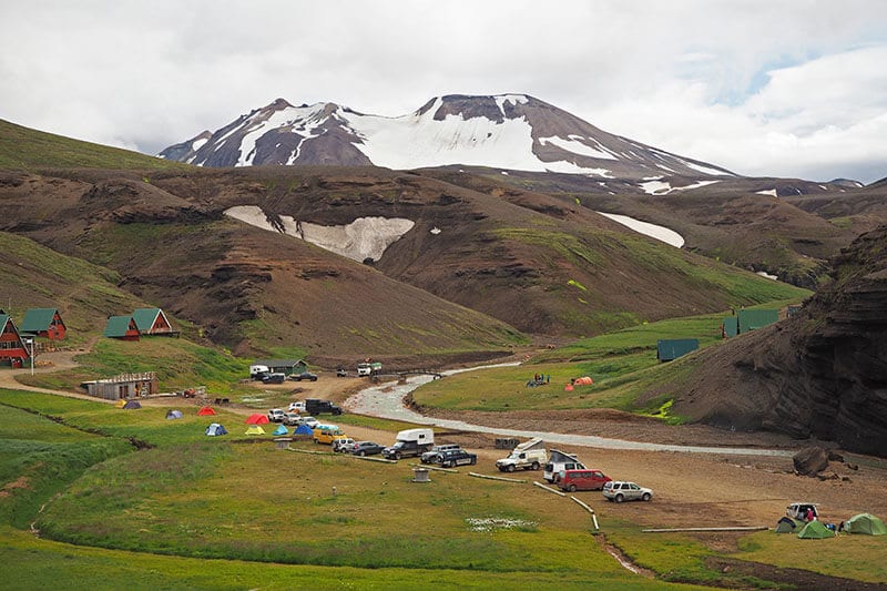 The Kerlingarfjöll Mountain area highlights some of the best features of the Highlands
F570 (Jokulshalsvegur)
This road is towards the very tip of Snæfellsnes peninsula, ascending from the southern part over to the northern side, just east of Snæfellsjökull glacier. If you want to get a good look at the magnificent Snæfellsjökull glacier, which is one of our favorites as we can regularly see it from Reykjavik on a clear day, this route offers a great opportunity to do so. It’s only about 18 km long but be ready to climb and descend fairly quickly, so it might not be a great idea to use it when the roads are snowy or icy. In fact, it is one of the highest roads in Iceland (2,158 ft).
 The majestic Snæfellsjökull glacier on a beautiful day
F575 (Eysteinsdalsleid)
This lesser known route is at the bottom of Snæfellsjökull glacier and might actually not be marked with the traditional “F” on location if memory serves us right. It is located north of Snæfellsjökull and runs from F570 to the main road of 574 by the coast. This is a great road to take if you want another perspective of the beautiful glacier.
F578 (Arnarvatnsvegur)
In our “dangerous roads” section above.
F586 (Haukadalsskardsvegur)
This 35 km long route crosses the bottom of the Westfjord’s “neck”, running from the main Vestfjarðarvegur (60) in the west over to the the main ring road (1) in the east. It’s a highly underrated road and offers some beautiful scenery as you drive past Haukadalsvatn lake. The road can be quite challenging and if you are trying to access it from the ring road, you will need to cross a gate.
F735 (Thjofadalavegur)
This route is located just northeast of Langjökull glacier in the western part of the country. It runs from Þjófadalir towards the Hveravellir geothermal pool area. It only features one significant river crossing, but the bottom can be quite rocky, so please use caution.
F752 (Skagafjardarleid)
Once you reach Varmahlíð in the north, turn south onto road 752 until it turns into road F752 as you approach the northern part of Langjökull glacier. Once you are off the comfortable pavement of road 752, expect a challenging journey and much slower speeds. As usual, be most careful when crossing the numerous creeks and rivers on this route, and see the below video for one of the most significant river crossings you can expect.
F752 – Crossing a river on Skagafjarðarleið. Video: Luc Chalsège
F821 (Eyjafjardarleid)
From Akureyri, the capital of the north, you can drive directly south via road 821. After 44 km, or approx. 45 min. drive, this road will turn into F821. This is a beautiful drive that highlights some of the most beautiful aspects of remote, northern landscapes. Eventually, you will meet up with F752 (see above), which in turn will meet up with the famous Sprengisandsleið (F26). The road will take you just over 3,000 feet (950 m) above sea level and offers stunning scenery.
 F821 – A beautiful drive through the remote northern areas
F839 (Leirdalsheidarvegur)
This road begins just south of Grenivik in the north, just north of Akureyri. It leads to Hvalvatnsfjörður and is only about 27 km long. It is an out-and-back trip, as you will have to take the same road back when you’re done exploring this area. Expect to cross a few creeks and rivers, although none of them are very deep.
 F839 – expect to cross a few creeks and rivers. Photo: Benny
F862 (Dettifoss)
Chances are that you have heard of the powerful Dettifoss waterfall. But do you know how to get there? There is actually more than one way to get there. Most people get there from the east side, taking road 864. However, you can also access it from the west side, taking road 862. Coming from the south, as many do after exploring the Myvatn area, turn north from the ring road (1). Keep driving on the relatively easy road 862 until you reach the paved parking lot ad Dettifoss. Enjoy the scenery like you see in the photo below. However, if you want to continue north, this road turns into a mountain road and is much more difficult. Many people choose to do this to reach the beautiful Asbyrgi canyon, which we highly recommend and is actually a part of our Happy Challenge.
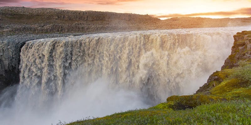 Dettifoss seen from the western side, accessible by road 862
F881 (Dragaleid)
This 18 km route links the famous Sprengisandsleið (F26) with F821 (see above). This is Iceland’s highest road, reaching 3,097 ft (944 m) of elevation. This road receives very minimal maintenance and is not used much, although the good news is that there are no river crossings. Just like much of the F26, this route could be fun if you want to know what it’s like to be on the moon.
F894 (Oskjuvatnsvegur)
This short route (8 km) takes over from F910 and leads all the way up to the Vikraborgir car park by lake Askja. It is surrounded by black lava and therefore offers a very unique landscape. But just like F910, this road is in horrible shape and we do not recommend using it.
F899 (Flateyjardalsvegur)
This road runs through Austurárdalur and runs parallel to the aforementioned F839. The route begins just north of Akureyri and takes you on the 34 km journey through the valley towards Flateyjardalur and the abandoned Brettingsstaðir farm. This farm was the last farm to be abandoned in the fjord (1953) and offers a glimpse into the past. Be prepared to cross a few shallow creeks and streams.
F899 – Flateyjardalur in all its glory.
F902 (Kverkfjallaleid)
This 84 km route runs from F905 (below) to the stunning Kverkfjöll mountains, located in the northern parts of the Vatnajökull glacier. This area is a local favorite but is rarely visited by the casual traveler for obvious reasons. The road is challenging, reaches 2.900 ft. (880 m) of elevation, and features some deep river-crossings. This is a very remote area, so please be very prepared with food, fuel, directions, etc.
 F902 – The view near Kverkfjöll
F903 (Hvannalindavegur)
You won’t even find this road listed on Google. But F903 runs from F910 to F902 and draws its name from the Hvannalindir nature center. Hvannalindir is a unique oasis where water flows from underneath the glacier, allowing vegetation to grow in an otherwise barren and desolate environment. Just like with all the roads in this area, it is extremely remote and features river crossings. It follows the same river, and you are required to cross it twice, so please be careful.
F905 (Arnardalsleid)
This 66 km route runs from road 901 (Möðrudalsleið), which you access via the ring road, to F910 (see above). As F910 leads to Askja, this is a fairly common route to take on your way to that beautiful lake. You can also take this route to get to F902 (see above) on your journey to Kverksfjöll. Just like all the roads in this area, it is remote and challenging. This particular road features some serious river crossings, so use your common sense and be very careful.
 F905 – Things can go wrong quickly. Be careful and don’t exceed your comfort level. Photo.
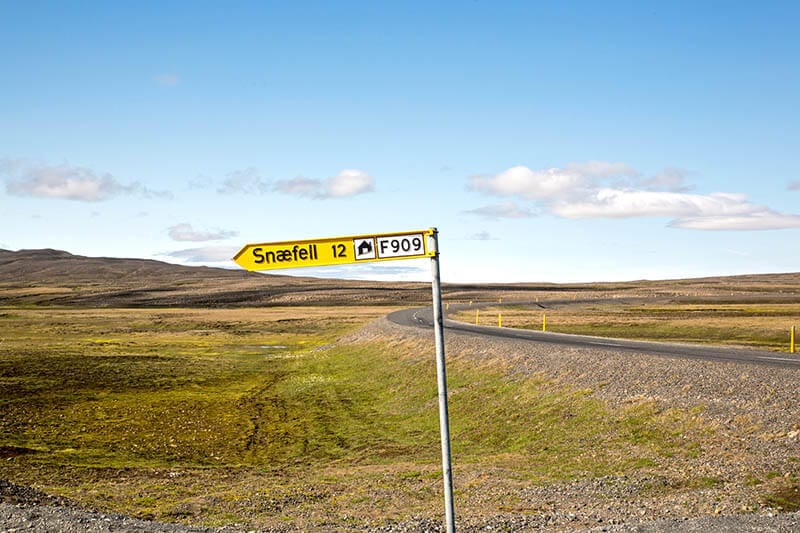
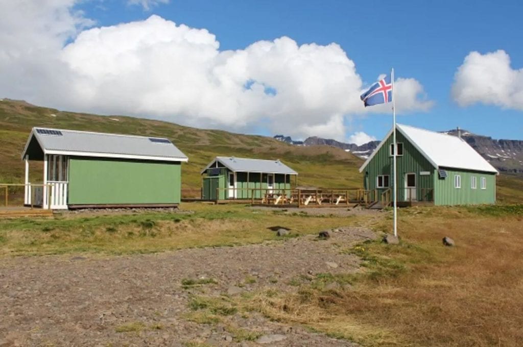
F909 (Snaefellsleid)
Snæfellsleið is a 32 km route that runs from Austurleið (F910) to the northern part of Vatnajökull glacier. This extremely challenging route runs past Snæfellsskáli hut, where you can seek advice from a ranger who occupies the hut during the summertime. In fact, this road is often considered one of the most challenging routes in Iceland and features many deep river crossings.
 F909 – This route is more challenging than it appears. Photo: nordbilder.com
F910 – Austurleid
In our “dangerous roads” section above
F946 (Lodmundarfjardarvegur)
This road is not only difficult to pronounce, coming in at a staggering 21 letters, but it’s also difficult to drive. You can expect some serious hills but the beautiful scenery makes it all worth it. From Borgarfjörður Eystri in the east (highly recommended area to explore), take road 946 south until it turns into F946. The 38 km route then leads to Klyppsstaðir, a mountain hut that includes up to 38 sleeping bag spaces. The road does not connect to another road, however, so be prepared to take the same route back.
 F946 – Klyppsstaðir. Photo: East.is
F980 (Kollmuluvegur)
In our “dangerous roads” section above
F985 (Jokulvegur)
This 17 km winding route runs from the ring road (1) to the Jöklaskel glacier base camp. From there, you can book various adventure tours, such as glacier tours with Glacier Jeeps. The first 11 km of the route are fairly easy but the last 6 are much more challenging. This area of the Vatnajökull glacier has some cool history, including the filming of scenes in the James Bond movie and Game of Thrones.
F985 – This video takes you through the entire route. Video by J. Magne
Favorite F Roads
Now let’s take a look at some of our favorite mountain roads in Iceland. These roads highlight some of the best features of the Icelandic Highlands, and we highly recommend driving them if time and conditions allow.
Kjolur (F35)
This is one of the more popular mountain routes that connects the north and the south of Iceland. This road is fairly easy to drive and a great introduction to the highlands for those experiencing them for the first time. It’s also a logical route after visiting the popular Gullfoss and Geysir attractions as a part of the Golden Circle.
The road will lead you to many interesting places and roads, such as Hagavatn lake and Nyifoss waterfall, accessible by road F335, which connects to Kjalvegur.
Oskjuvegur (F88)
Öskjuleið (F88) runs 80 km from the Ring Road from Hrossaborg, past the beautiful Herðubreið mountain and towards Askja lake (see more about lake Askja below)
You’ll also find Herðubreiðarlindir just north of Herðubreið, which is a wonderful oasis full of vegetation and small creeks. Make sure to check out the ruins of Eyvindarkofi as well, made by the infamous Fjalla Eyvindur outlaw in the 18th century.
Landmannaleid (F225)
A 41 km road from road 26 to the gorgeous Landmannalaugar, one of Iceland’s natural jewels. But as much as you might be looking forward to arriving at your destination, don’t forget to enjoy the journey. You will see lots of interesting things along this short route, such as the beautiful mountains Rauðufossafjöll and Loðmundur, the Rauðufossar (“Red falls”) waterfall, and Landmannahellir cave.
Kaldidalsvegur (550)
“The Cold Valley Route” is a 63 km stretch of beautiful scenery between Thingvellir National Park and Húsafell. It is technically not an F-road but is off-limits for most non-4×4 car rentals as it is located in the highlands. The road runs parallel to Þórisjökull and Langjökull glaciers, which offers a magnificent view when the weather allows.
The road was a popular horse riding path until motor traffic was allowed there in the 1930s. There are no river crossings on this route and is generally an easily passable road, so it is perfect for beginners.
Sprengisandsleid (F26)
Yes, this road was on our dangerous roads list. Check that out above for some reasons why you need to be careful driving this road. We include it here for a couple of reasons. One, you can drive this road while avoiding the most dangerous parts of it. Two, a small part of this road leads to the beautiful Aldeyjarfoss waterfall, which is one of Iceland’s most unique attractions.
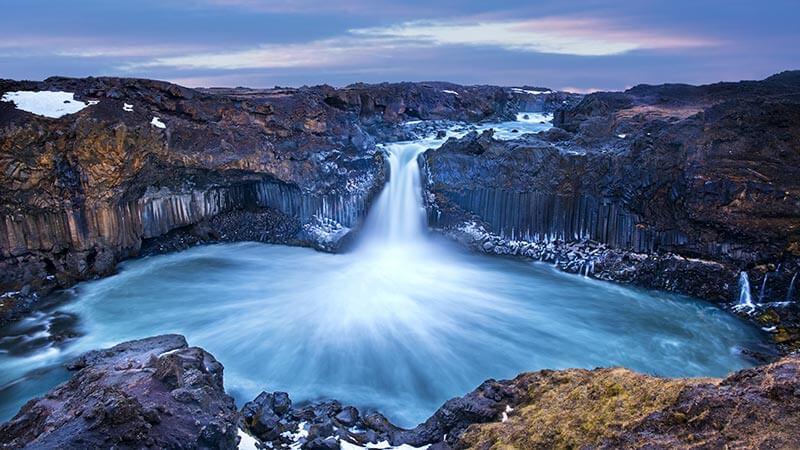 The magnificent Aldeyjarfoss waterfall
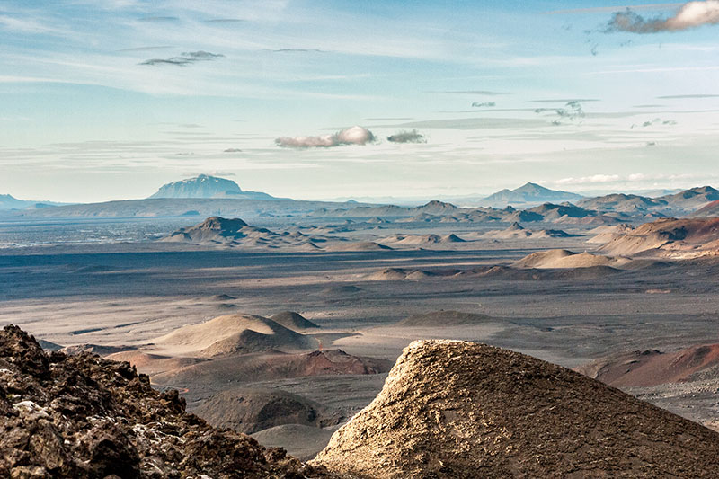
Beyond the Aldeyjarfoss waterfall, Sprengisandsleid features some of the most barren and desolate landscapes in Iceland. The 200km road gets its name from Sprengisandur, a vast and barren plateau between Hofsjokull and Vatnajokull glaciers. Sprengisandur is rich in history and folklore and provided a hiding place for many outlaws throughout the centuries.
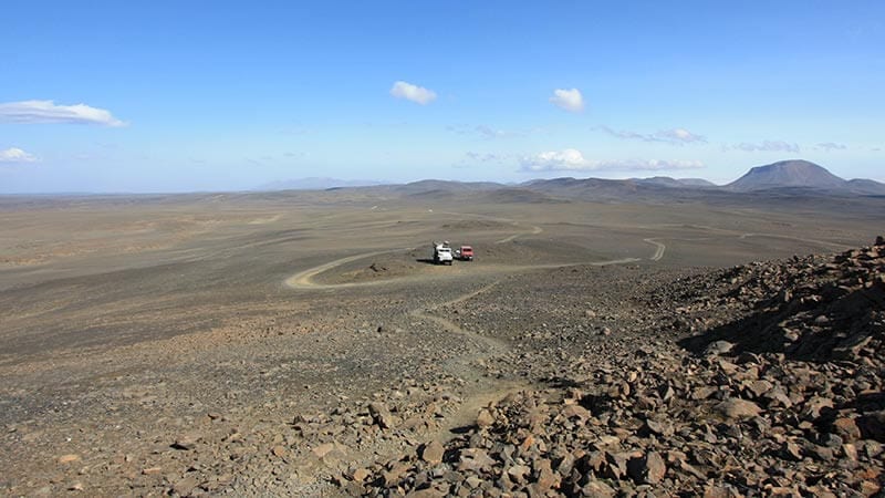 The desolate terrain of Sprengisandur
Keep in mind that even though we highly recommend these routes, some of them will require you to cross rivers and you always do so at your own risk.